PLOCAN Marinha IH OOM


Glider Mission Madeira-Canarias


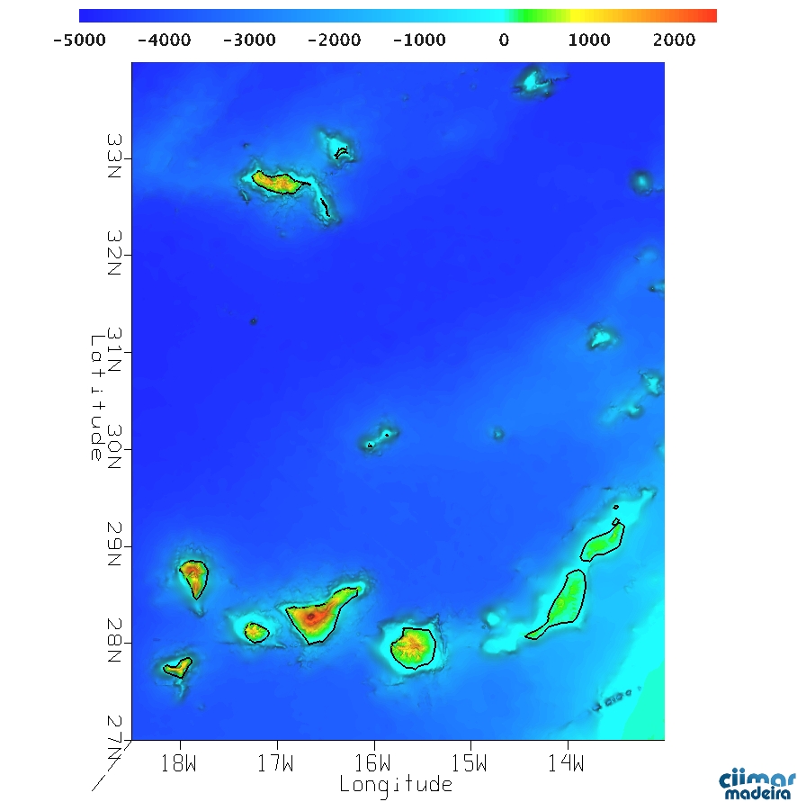
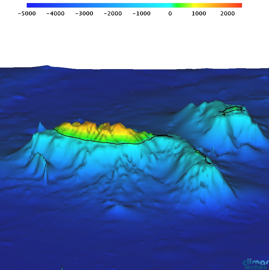
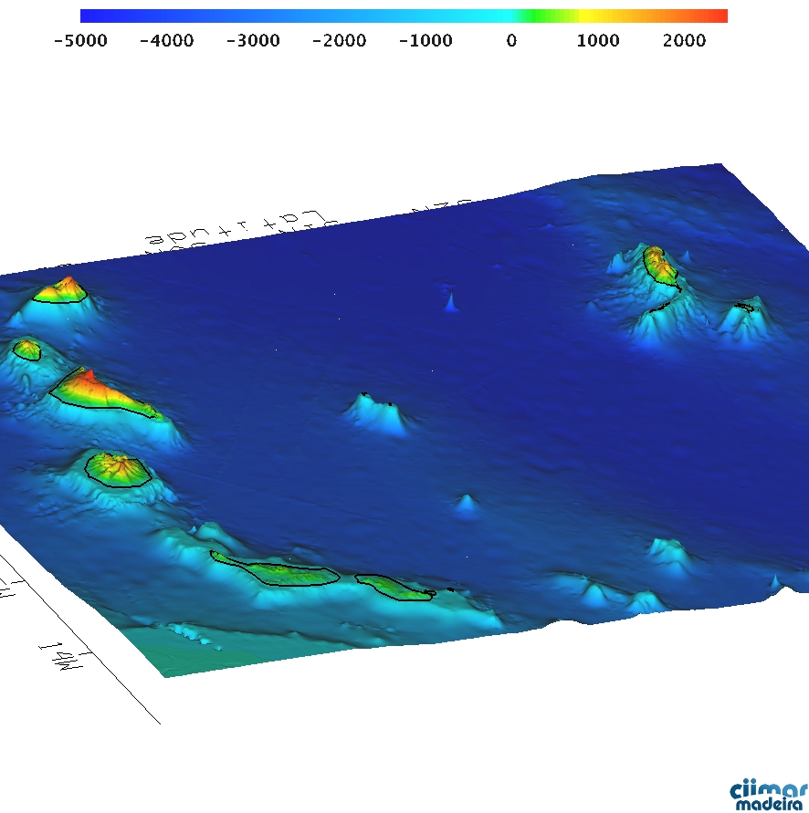
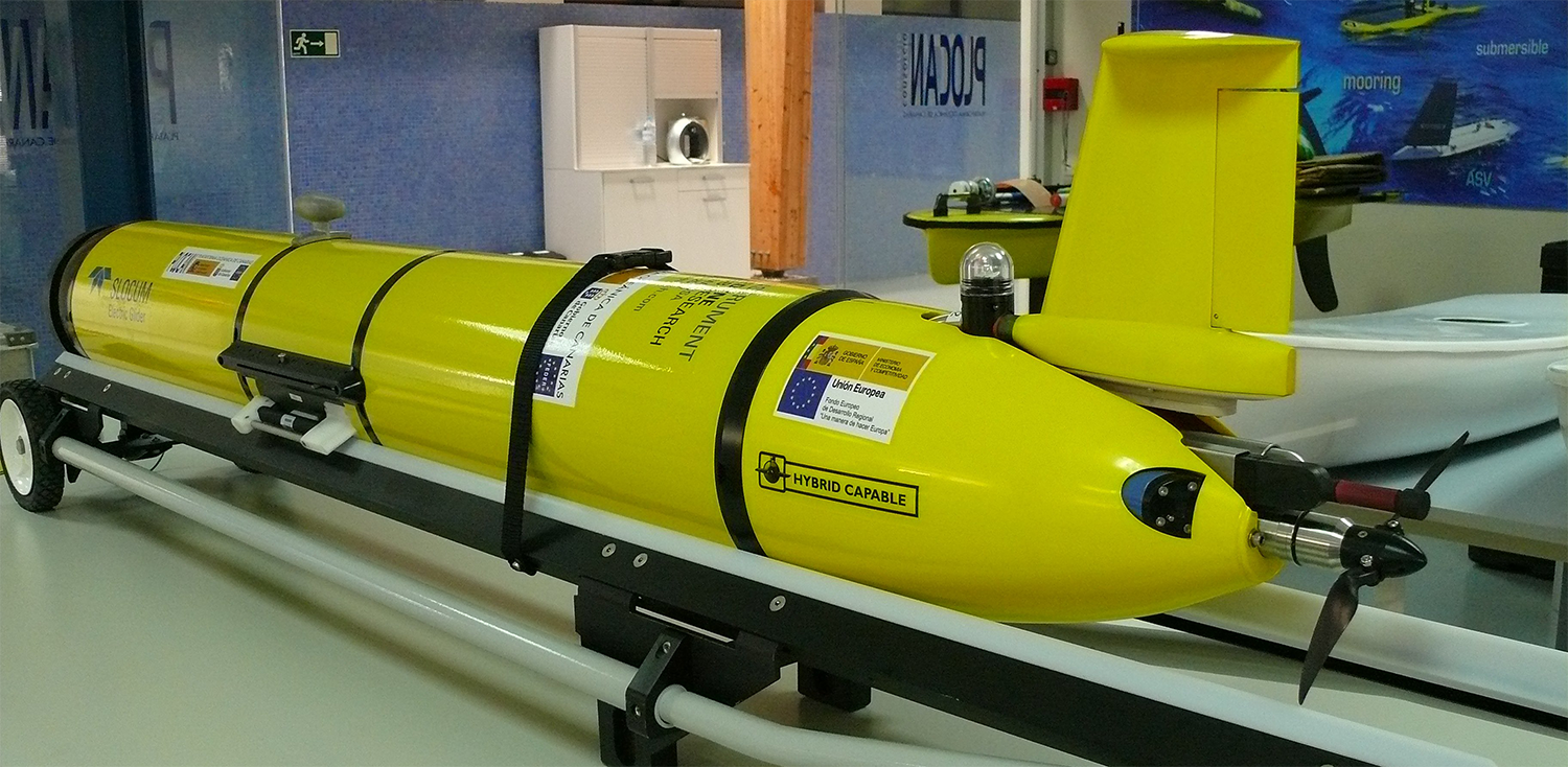
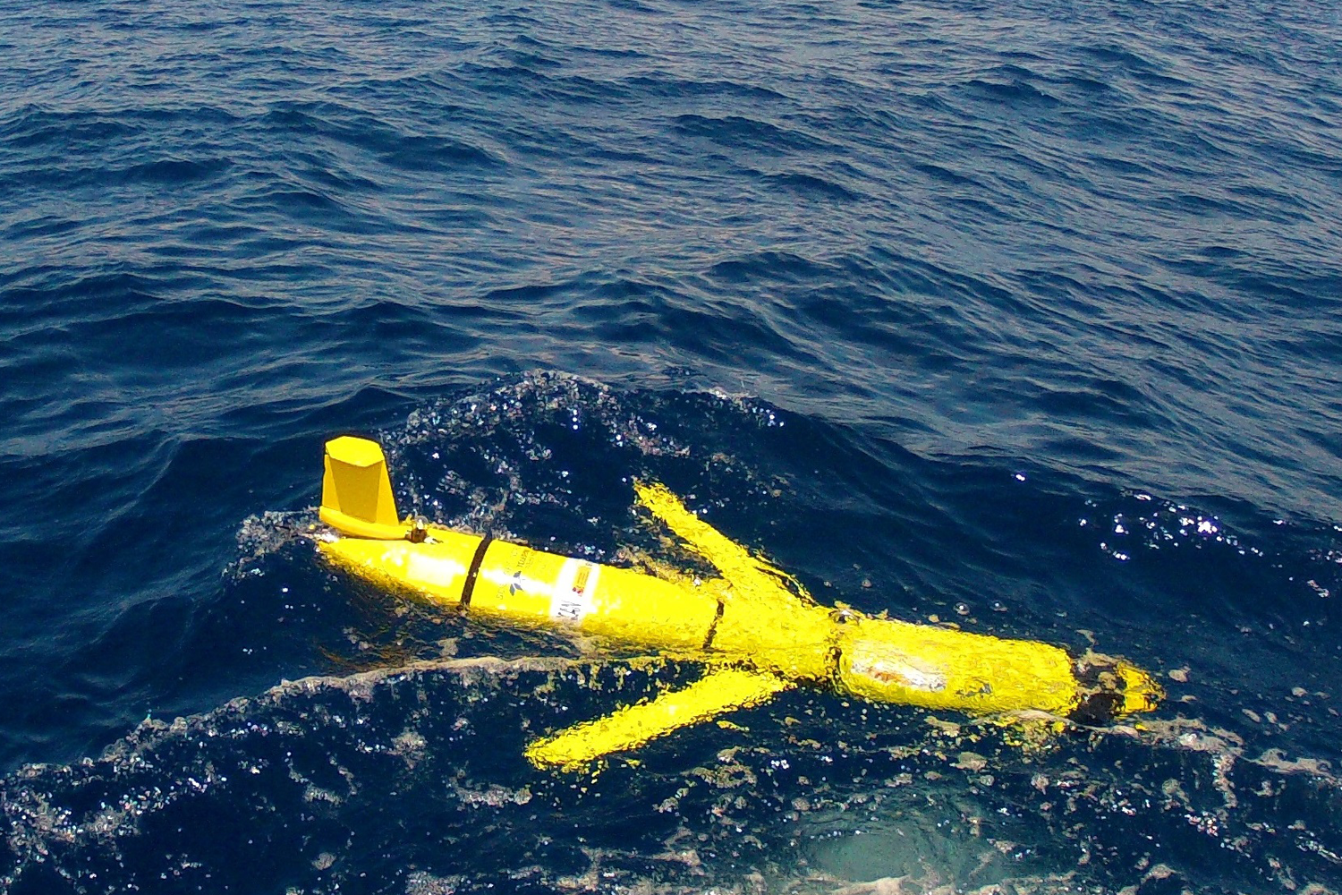
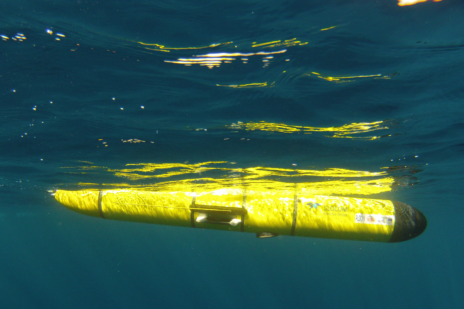
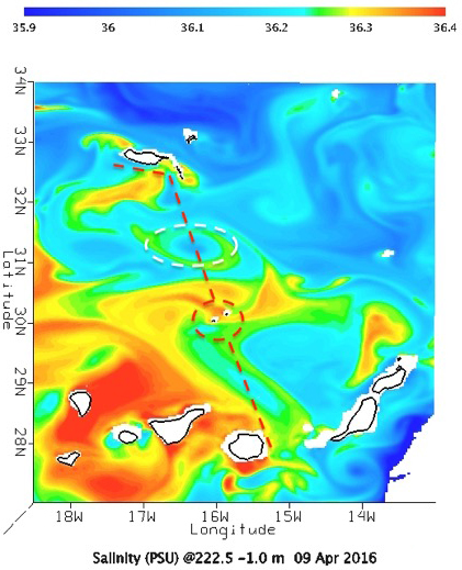
Within the framework of AtlantOS-H2020 EU-project, a partnership between OOM, Instituto Hidrografico-Marinha (IH) and Oceanic Platform of the Canary Islands (PLOCAN), has planned a scientific mission to cross the NE Atlantic Ocean, between Madeira and Gran Canaria, during April and May 2016. A 'Slocum G2 glider’ (+info), with a payload of scientific instruments to measure conductivity, temperature, pressure, dissolved oxygen, chlorophyll and turbidity, will be deployed from the the Portuguese Navy Vessel (N.R.P. ‘Zaire’). The glider will be remotely piloted during approximate 250 nautical miles, and it will be doing repeated dives (casts) through the water column down to 1000 m depth. This pioneering initiative in the Macaronesia Region will help develop a new scientific approach to validate and improve regional-scale forecast models and satellite products, including water masses characterisation. Follow the glider here: http://gliders.plocan.eu

Glider Pic1         Glider Pic2         Glider Pic3

Path


Graphical 3D representation of the regional bathymetry (m)


SERVER IS DOWN

Please try later

Ocean Forecasts

US National Weather Service, National Centres for Environmental Prediction (NCEP) wind and wave forecast using, WAVEWATCH III (model version 3.14). With version 3.14 some options for extremely shallow water (surf zone) have been included. Forcing winds come from the Global Forecast System (GFS). More details here: http://polar.ncep.noaa.gov/waves/
MERCATOR is an operational Global Ocean Circulation product, provided daily by 'myocean'.The 'Atlantic-Iberian-Biscay-Irish' (IBI36) is 5-day hydrodynamic Regional forecast based on a (eddy-resolving) NEMO-model application run at 1/36 degree (~3km) horizontal grid resolution, updated daily. Plotted model variables include: i) Sea Surface Height (SSH); ii) Temperature; iii) Salinity; iv) ocean current vectors over flow speed. You can visualize maps in the approximate model-depths: 0,100,200,300,500,750,1000 meters.
Wind & Waves Sea Surface Height Temperature Salinity Currents

Depth (m):


Forecast

Previous Play/Pause Next


Satellite Observations

Satellite derived observations include: i) Sea surface height from AVISO; ii) Sea Level Anomaly (SLA), from AVISO iii) Sea Surface Temperature (SST), extracted from NASA’s ‘Group for High Resolution Sea Surface Temperature' (GHRSST); iv) Ocean Surface Currents derived from satellite altimeter and scatterometer data (OSCAR); v) Monthly averages of Chlorophyll-a derived from daily Level-3 standard mapped image (SMI) with 4.6 km resolution (MODIS-Aqua).

Sea Surface Height Sea Surface Temperature Sea Surface Currents Sea Level Anomaly Chlorophyll-A


Observation

Previous Play/Pause Next


ARDITI Cofinanciamento


© 2023 Oceanic Observatory of Madeira | Developed by Carlos Lucas